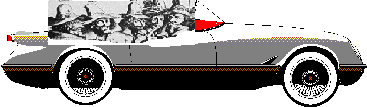
In Pursuit of the Conspirator's Trail via Motor Car in 1996
Word is just in from our English office that two of the Fawkesians, Larry
and Lois Murphy, have launched in the wilds of the Midlands, deep within
the English countryside, a journey to locate the remnants of the landmarks
of the route through which the brave band trekked after fleeing London.
 We shall closely follow every
dispatch from our brave explorers as it comes in. They promise to post
pictures when they arrive from the processors. Mileage is listed between
points with parenthesis around total mileage. For example, 4 miles (50
miles) means 4 miles since the last point and 50 miles on the odometer. We shall closely follow every
dispatch from our brave explorers as it comes in. They promise to post
pictures when they arrive from the processors. Mileage is listed between
points with parenthesis around total mileage. For example, 4 miles (50
miles) means 4 miles since the last point and 50 miles on the odometer.
Before you ask, the entire
trip takes 130.9 miles.
This is the story thus far:
Dunstable
We began in Dunstable.
This is a market town. We started at the Charter Market next to the public
car parking. The Charter Market has been in operation since 1131. You could
eat at the Priory Pub or the Mulberry Bush for all day family dining.
We drove down to A5 towards
Milton Keynes. We passed through Chalk Hill with a petrol station and a
pub at 1.7 miles (1.7 miles). After 0.3 miles (2.0 miles) at the roundabout,
continue on the A5 towards Milton Keynes through the lovely countryside.
You will pass a Little Chef with a Travlelodge after 1.4 miles (3.4 miles).
For even cheaper food, continue on for 0.4 miles (3.8 miles) to the McDonalds.
This is directly before the village of Hockliffe, a large village with
the Red Lion Pub. Woburn Abbey would be a diversion from here.
Continuing on into the countryside,
you will reach another petrol station after 3.3 miles (7.1 miles). After
0.7 miles (7.8 miles), you run into the Fox and Hounds free house. You
enter Buckinghamshire after 0.4 miles (8.2 miles) and you'll need to watch
out for deer after 0.7 miles (8.9 miles)!
You'll note a lovely view of
Milton Keynes after another 1.1 miles (10 miles) as you descend the hill.
In another mile (11 miles), you run into a Little Chef and petrol station.
At the roundabout, continue on the A5 towards Milton Keynes. This turns
into a dual carriageway after 0.6 miles (11.6 miles). Upon seeing the Milton
Keynes signs, you could take a diversion to Bletchley Park, the first home
of GCHQ's ancestor. There is also a lake after 0.4 miles (12 miles) on
the right. After another 1.2 miles (13.2 miles) you could divert to the
Tourist Information Center.
Leaving Milton Keynes, you'll
be welcomed into Northamptonshire after 6.9 miles (20.1 miles). After another
0.5 miles (20.6 miles), continue at the roundabout on the A5 towards Hinckley.
There is a Little Chef at the roundabout. This now turns into a single
carriageway and you continue out into the countryside.
After another 2.0 miles (22.6
miles), you'll enter Potterspury with its antique shops in stone buildings.
It also has the Famous Hungry Horse after 0.3 miles (22.9 miles). If you
get adventurous, try the Super Sausage Cafeteria, a lorry stop, after 0.3
miles (23.2 miles). Then you will continue out into the countryside with
picturesque farms.
After another 1.6 miles (24.8
miles), you'll run into another antique shop, followed directly by two
petrol station after 0.1 miles (24.9 miles). Continuing on, after 0.4 miles
(25.3 miles) you could stay at the Plum Park hotel. After another mile
(26.3 miles), you could divert to the Canal Museum, which is well signposted
in Stoke Breurny. Continue on, you could go to the Towcester Races after
0.7 miles (27 miles.) If you get thirsty, stop at the Charles Wells Pub
after 0.1 miles (27.1 miles).
After 0.2 miles (27.3 miles),
you come upon the lovely town of Towcester. This is a Roman town with antique
shops. This would be a good place for a nice place to park and take a walk
to stretch you legs and walk the riverwalk. We took three pictures here.
You could fill up with petrol
after 0.2 miles (27.5 miles) and fill your stomach after another 0.1 miles
(27.6 miles) at the White Bear. Next door (27.6 miles) is the Waiting Well
Inn. Stop in another 0.1 mile (27.8 miles) are Public convienences.
After 0.8 miles (28.4 miles),
you'll into a petrol station and a roundabout. Continue straight through
towards Hinckley. Another 0.5 miles (28.9 miles) you'll come across a cafe,
a petrol station, and more convieninces. The cafe has a limited menu.
Fosters Booth is another 2.9
miles (31.8 miles). This town has Pegotty's Rest and the Red Lion Pub.
1.3 miles (33.1 miles) you'll see the signpost for Cannon's Abbey, which
is 6 miles off the path. After 0.9 miles, you could stop at the Old Dairy
Farm Craft Center. If you get tired, stop at the Narrow Boat Rest in 1.2
miles (35.2 miles). Need petrol? Stop at the petrol station in 0.3 miles
(35.5 miles).
Weedon, a small town, is another
0.4 miles (35.9 miles) down the road. At the light after 0.2 miles (36.1
miles), turn left to Daventry on the A45. Note the Globe hotel and antique
shops on the left hand side. Another 0.1 miles (36.2 miles) you could stay
at the Heart of England hotel, a Tudor building. Back out into the countryside.
If your tank mysteriously became
empty in the last mile, there is a petrol station after 1.4 miles (37.6
miles). A beautiful stone farmhouse is on the right hand side after 0.8
miles (38.4 miles). The town of Daventry is 0.9 miles (39.3 miles), followed
by a Happy Eater in another 0.1 miles (39.4 miles). At the roundabout,
take the right turn towards the M1 North. After 0.2 miles (39.6 miles),
continue on at the roundabout towards M1 North. As the is land of roundabouts,
after another 0.9 miles (40.5 miles) you continue straight through the
roundabout towards the M1 North. Again in 0.8 miles (41.3 miles) continue
straight through the roundabout towards the M1 North. At 0.3 miles (41.6
miles) continue straight through the roundabout towards Ashby St. Ledgers.
In 2.3 miles (43.9 miles), we turn right at the sign to Ashby St. Ledgers.
Ashby St. Ledgers
At Ashby
St. Ledgers, park at the car park at the Olde Coachhouse Inn at 0.2
miles (44.1 miles) and toss a pint back. A lovely timber framed pub and
restraunt, the food is highly recommended. At 5 to 8 pounds for a lunch,
the prices are good. Drive towards the end of village past the thatch roofed
cottage and stone buildings towards the church at 0.3 miles (44.4 miles).
The St. Leodegarius church has been around since at least 1186, and the
present building has been there since the early 14th century. In the village,
you'll see the room where Catesby and Fawkes met. It is currently under
construction, but it still stands. We took one picture of the pub, a picture
of the cottages, one picture of the church, and three pictures of the Plotting
Room.
Leaving Ashby St. Ledgers back
through the way we came, turn right on the A361 towards Daventry after
0.5 miles (44.9 miles). On the right after 1.2 miles, turn right towards
Braunston. After 1.3 miles (46.2 miles), you enter Braunston, a quaint
small town with its old buildings. Turn right at the T intersection after
another 1.1 miles (47.3 miles) towards Coventry on the A45. At the intersection
you'll see the Old Plough pub. You'll also see the Mill House, a fine looking
restaurant. After 0.8 miles (48.1 miles), you enter Warwickshire, Shakespeare's
county. After another 0.2 miles (48.3 miles), you enter Willoughby, with
its two petrol stations after 0.1 miles (48.4 miles). A roundabout greets
you after 3.1 miles (51.5 miles), at which you need to go straight on the
B4429 towards Dunchurch. Traveling 0.2 miles (51.7 miles), you reach our
second destination, Dunchurch.
Dunchurch
At Dunchurch,
park at the car park on the left. This little market town with its thatched
roof cottages has the Guy Fawkes House on the right as you enter the town.
A small plaque commemorates house. We took three pictures, two of the house
and one of the plaque. Stop and eat at the Prosperous Pig or the other
pubs and restraunts in the town. Or shop for antiques and stretch your
legs.
Continuing on the B4429, you'll
find a petrol station after 0.4 miles (52.1 miles) and another after 0.9
miles (53.0 miles). Be prepared after the roundabout at 0.5 miles (53.5
miles) to make a left turn onto the service road towards Princethorpe on
the B4453 in front of the Little Chef at 0.3 miles (53.8 miles). Once you
take the turn, continue on the B4453 towards Princethorpe. This will take
you through a windy road until you reach the little hamlet of Princethrorpe
after 3.2 miles (57.0 miles).
After another 0.2 miles (57.2
miles), make a right turn onto the A423 to Coventry. Almost immediately
{ after 0.1 miles (57.3 miles) }, take a left turn towards Leamington onto
Leamington Road. After 0.5 miles (57.8 miles), you'll see the Princethorpe
College on the right side, an impressive brick structure with a tower.
Hungry? Stop at the Woodhouse restraunt and hotel after 0.6 miles (58.4
miles). Meander along for another 1.5 miles (59.9 miles) until you reach
an intersection. Continue on towards Leamington. You'll run through Weston
and the Bull Inn. Continue on to Leamington when the road vears right.
After 1.9 miles (61.8 miles),
you reach Cubbington. Two petrol stations greet you after 0.1 miles (61.9
miles). Cubbington is a large village with a beautiful church. Cubbington
has Chinese food, fish and chips, and pubs. After 0.6 miles (62.5 miles),
you'll enter Leamington Spa. Petrol can be bought again after 0.7 miles
(63.2 miles), which neighbors the Walnut Tree pub. Journeying another 0.4
miles (63.6 miles), you reach a roundabout, which you must turn left onto
the A445 towards Warwick. Almost immediately { 0.1 miles (63.7 miles) }
you reach another roundabout which you must turn right at towards Warwick.
This is the A442 or A445, depending on which sign they put up. After another
0.5 miles (64.2 miles), countinue straight through the roundabout towards
Warwick. Many pubs and guest houses can be found on this road. After 0.2
miles (64.4 miles), you'll see St. Marks Church. After 0.7 miles (65.1
miles), follow A445 towards Warwick, which is a right. You enter Warwick
after another 0.1 miles (65.2 miles). You'll need to bear left after another
mile (66.2 miles). Follow the signs to Warwick Castle, which tell you take
a right at the roundabout after 0.2 miles (66.4 miles). Almost immediately
follow the sign to the car park onto Castle Lane. This will cost 1.60 quid
to park at our next destination, Warwick Castle.
Warwick Castle
At Warwick
castle, you'll see one of the best preserved castles in England. It is
very touristy and don't go on a bank holiday. They have sections about
each of the periods in there history, from the Normal Conquest to the present
day. They also have a mulitmedia experience, which is very Disney-esk.
It is, however, very expensive to get in to the castle.
Norbrook
We wanted to go to Norbrook
after Warwick, but we couldn't find it. We found Snitterfield, which is
the closest village. More when we actually do find it. For now, we head
onto Clopton.
Continue on Castle Lane, which
end at a T junction after 0.3 miles (66.7 miles). Turn left towards Stratford
on the A429. Two petrol stations are found after 0.4 miles (67.1 miles).
At the roundabout in another 1.2 miles (68.3 miles), take the A46 towards
Statford. There's a parking spot after 0.9 miles (69.2 miles) and the Hillcrest
Hotel after 0.7 miles (69.9 miles). After 0.7 miles (70.6 miles), you need
to take the A439 towards the Stratford town center at the roundabout, a
left.
At 0.7 miles (71.3 miles),
there is a information and parking spot on your left. It has a good quality
map. After 2.1 miles (73.5 miles), you'll come across the Oxtail Farm B&B.
You'll then pass Avon Caravan park after 0.1 miles (73.6 miles), and come
upon the Welcombe Hotel and Golf Course.
Clopton
This may be the Clopton Hall, but I am
not sure. A side detour to Clopton itself yeilded no old manor house. But
I will continue to search.
Passing the golf course, you
hit parking for Stafford at 0.4 miles (74.0 miles) and 0.6 miles (74.6
miles.) As Shakespeare was an Elizabethan-Jacobean figure, a stop in Strafford
is certainly worth the diversion.
At the split in the road after
0.2 miles (74.8 miles), take a right and a left onto the A9300 towards
Birmingham. After 0.2 miles (75.0 miles), you'll continue straight at the
roundabout on the A9300. Continue through the next roundabout at 0.5 miles
(75.5 miles) and take the left at the roundabout at 0.8 miles (76.3 miles)
onto the A46 towards Evesham. After 1.3 miles (77.9 miles), take a right
at the roundabout towards Evesham. You'll pass the Stag at the Redhill
Hotel after 2.2 miles (80.1 miles). At the next roundabout at 3.3 miles
(83.4 miles), take the right on the A435 towards Birmingham. You'll see
a Little Chef at the next roundabout after 0.6 miles (84.0 miles) and continue
straight on the A435 towards Coughton Court. After 0.9 miles (84.9 miles),
follow the sign at the roundabout towards Coughton Court, which will be
a left. You'll run across the Moat House Inn after 0.4 miles (85.3 miles)
and the Kings Court Hotel and Restraunt after 0.2 miles (85.5 miles). Parking
is another 0.2 miles (85.7 miles) down the road and the Cougton sign is
0.3 miles (85.8 miles) from it. The entrance on the right hand side to
Coughton Court is 0.3 miles (86.1 miles) down the road.
Coughton Court
Coughton
Court is now a National Trust property, even though the Thockmortons
still live in it. It has a fascinating Gunpowder Plot exhibit and priest
hides. This is one of the highlights of the tour. We took four pictures
here.
Continuing on our journey,
leave Coughton Court and take a left at the end of the driveway back towards
the way you came in. This is about 0.2 miles (86.9 miles) from when you
turned into the entrance at Coughton Hall. Continue towards the roundabout
at 0.8 miles (87.7 miles) and go left at the roundabout towards Alcester
on the A435. After 0.6 miles (88.3 miles), go through the roundabout towards
Evesham. After 1.1 miles (89.4 miles), take the right at the roundabout
towards Worcester and Ragley Hall. After 0.2 miles (89.6 miles), you'll
pass through Arrow Town, with its quaint Tudor houses. You'll need to take
the right after 0.1 miles (89.7 miles) on the A422 towards Worcester, unless
you want to take a diversion to Ragely Hall. We've never been there.
After 1.8 miles (91.5 miles),
turn left onto the A422 and an immediate right. After 1.0 miles (92.5 miles),
you'll pass a petrol station on the left hand side. After 1.7 miles (94.2
miles), you pass through Inkbarrow, which we didn't find interesting. After
0.5 miles (94.7 miles), you'll see the Bullshead Inn and a few Tutor houses.
Petrol can be had in 0.3 miles (95.0 miles). You could eat at the Red Heart
Inn after 2.4 miles (97.4 miles) and get even more petrol after 0.4 miles
(98.1 miles). Hungry again? Eat at the Flyford Arms Pub, a B&B, after
0.2 miles (98.3 miles). Petrol again after 0.3 miles (98.6 miles). After
0.7 miles (99.3 miles), turn right at the signpost towards Huddington.
After 0.9 miles (100.2 miles), turn left onto the B road towards Huddington.
The mill farm on the left side at 1.3 miles (101.5 miles) is quaint, and
is 0.1 miles from Huddington Court, which is on the left hand side.
Huddington
Huddington
is a private home with a working farm. There is a pathway to the church
there, which is public. The church is lovely and has many monuments to
the Wintour family.
Continue down the road and
after 0.4 miles (101.9 miles) take a right towards Himbleton. The signpost
is hard to see on the righthand side. After 0.3 miles (102.2 miles), you
pass through the metropolis of Himbleton, which has a few modern houses
and a farm. After 3.2 miles (105.4 miles), take the right onto the B4090
towards Alcester. After 0.3 miles (105.7 miles), you'll pass the sign for
Hanbury Hall. Too modern to have any connection to the Plot, it is an interesting
diversion. After 1.5 miles (107.2 miles), you reach Hanbury itself. Turn
left on the B4091 towards Bromsgrove. After 1.0 miles (108.2 miles), you
reach the Country Girl pub. After 0.5 miles (108.7 miles), you reach the
village of Stoke Prior, which is industrial with modern towns. You'll run
across the Navigation Inn after 0.6 miles (109.3 miles), and the Ewe and
Lamb after 0.8 miles (110.1 miles). After 0.2 miles (110.3 miles), take
the right on the A38 towards Bromsgrove.
After 0.7 miles (110.8 miles),
you continue through the roundabout. After 0.3 miles (111.1 miles), turn
right at the light, towards Aston Fields. At the intersection at 0.5 miles
(111.6 miles), take the right. You'll pass the Cross Inn at 1.5 miles,
where you must take a right at T. After 1.6 miles (113.2 miles), you come
upon the Tarderridge. You make a left towards Burcot on Hewell Road. In
0.2 miles (113.4 miles), you need to take the right towards HMP Hewell
Grange. It is not well signposted. After 0.1 miles, take another right
into the prison, through the roundabout and through the gate. You'll need
to come during visiting hours.
Hewell Grange
Hewell
Grange is now H.M.P. (Her Majesties Prison) Hewell Grange. The manor
house, which we took three pictures of, is a majestic house.
Leaving the prison, take the
left back to the Hewell Road. This will take about 0.6 miles (114.0 miles)
total from coming into the prison gate. After 0.7 miles (114.7 miles),
you come upon Boradgreen, a tiny village. After 1.2 miles (115.9 miles),
you come into Burcot. After 0.5 miles (116.4 miles), you come to a roundabout.
Take the A38 towards Birmingham, which is straight. After 0.4 miles (116.8
miles), you could stop for that petrol you've been putting off getting.
After 0.3 miles (117.1 miles), you could eat at the Malbrook Restraunt.
After 0.1 miles (117.2 miles), there is yet another petrol station. After
0.8 miles (118.0 miles), you come to an roundabout, which you continue
straight through on the A491 towards Strourbridge. Continue on the A491
until you reach the next roundabout after 1.7 miles (119.7 miles). After
0.4 miles (120.1 miles) you reach the Little Chef and a petrol station.
You need to get into the turn lane on the right hand side. You are going
to The Bell. Go into The Bell parking lot.
The Bell Inn
The Bell is the Bell Inn of old.
It is no longer an inn and has been taken over by the Toby chain. One part
of the Bell is a typical English pub, with the bar, game machines, a television,
hunting prints on the wall, and two fireplaces. It also has the timber
roof beams of pubs of the period. The other part of the Bell is a hunting
lodge type pub and restaurant. This part has antiques placed on its shelves.
The food is excellent and not overly expensive. They also have outdoor
seating and a jumpy castle for the kids. This place is highly recommended
for a meal and a pint. We took 4 pictures at the Bell: one of the lounge;
one of the sign saying, Bell Inn, circa 1600; and two of the outside of
the Bell, one without Lois and one with.
Leaving The Bell, you continue on the A491 towards Stourbridge for 2.0
miles ( 122.1 miles), take the left towards Clent. This is Bromsgrove Road.
You go through the very lovely village of Clent and come upon a roundabout
after 1.0 miles (123.1 miles), you come upon a roundabout. Take the right
towards Stourbridge. After 1.0 miles (124.1 miles), you meet up with the
A491 again and take the left. You'll come upon a roundabout after 0.1 miles
(124.2 miles), you take the left towards Hagley Hall, with its brown signpost.
After 0.2 miles (124.4 miles), take the left and an immediate right towards
Hagley Hall. At the split in the road after 0.2 miles (124.6 miles), take
the right towards Hagely Hall. After 0.2 miles (124.8 miles), you come
to Hagley Hall.
Hagley Hall
Hagley
Hall. is another large, impressive structure, but you cannot get into
Hall until 2pm (through 5pm). We took two pictures of the Hall. We also
took a picture of the St Pauls Parish church that is located with Hagley
Hall. It has many tombstones of the Littleton family, but the ones from
the period are too faint to see.
Following the signs back to
the A491, which is 0.6 miles (125.4 miles) from Hagely Hall. At the roundabout,
take a right which is the way you came in. After 0.5 miles (125.9 miles),
you take the left at the traffic light to stay on the A491 towards Stourbridge.
After 0.9 miles (126.8 miles), you hit another roundabout. You will be
continuing on the A491 for the rest of the journey, so follow all signs
that say A491. After 0.6 miles (127.4 miles), you reach the Crown Inn.
Old Swinford Lodge Restraunt is 0.1 miles (127.5 miles) down the road.
2 petrol stations are 0.1 miles down the road (127.6 miles). After 1.2
miles (128.8 miles), you come upon a split in the road. Continue on the
left on the A491. The Royal Oak is 0.1 miles (128.9 miles) and 2 petrol
stations are 0.1 miles (129.0 miles) farther. The Seven Springs restraunt
is 0.2 miles (129.2 miles) from here. The Little Pie is 0.1 miles (129.3
miles) from it.
My wife wanted to stop at the
Crystal Glass Center after 0.2 miles (129.5 miles), but we resisted the
tempation. However, the Stuart Crystal Center with its cone furnace should
not be missed after 0.3 miles (129.8 miles). The Rose and Crown Pub is
0.1 miles (129.9 miles) from this and the Old Cat is 0.1 miles (130.0 miles)
from that. Tired of pubs? Here are two more: the New Inn after 0.1 miles
(130.1 miles) and the Queen's Head after 0.1 miles (130.2 miles).
Again on the A491, you will
come upon Kingwinford. This lovely town has a glass works and glass museum.
It also has plenty of pubs and restraunts, including a Balti place (who
would have thought?) Continue on the A491 toward Himley Hall the light
after 0.5 miles (130.7 miles). After 0.3 miles (131.0 miles) you pass 2
petrol stations and you'll go under a bridge after 0.1 miles (130.8 miles).
You'll see the sign for Holbeache Nursing home after 0.8 miles (131.6 miles)
and the entrance is 0.1 miles (130.9 miles) on the right.
Holbeche
The Holbeche
house is now a nursing home. This looks exactly like the etchings. We took
2 pictures.
Going home
We took a diversion to Hanley Hall
and took two pictures. It is well signposted.
Hope you enjoyed the trip!
Interested in terrorism? Check out these links!
Have you tryed our route? Did we make any mistakes? Let
us know! |
|
 Motoring
the Conspirator's Route
Motoring
the Conspirator's Route